Showing posts with label JOBS. Show all posts

Friday, January 11, 2019


Postdoctoral Fellow in Remote Sensing of Coastal Ecosystems French Institute of Pondicherry - Puducherry, Puducherry

60,000 a month

A 2-year postdoctoral position is available from the 1st April 2019 in the GeoSMIT department, French Institute of Pondicherry, Pondicherry, India. The position offered will address the vulnerability of coastal ecosystems to a range of socio-economic pressures and physical processes typical of the Tamil Nadu coast facing the Bay of Bengal, as introduced in Muthusankar et al. (2018). Regions of Pichavaram mangroves and Kalivelli wetland will be focused on. Changes in the ecosystems themselves will be to described in function of surrounding land cover and land use transformations. The work has to be carried out within the framework of the 'Coastal transformations and fishing community wellbeing - synthesized perspectives from India and Europe, FISHERCOAST" project, funded by the EU-India Platform for Social Sciences and Humanities (EqUIP)program. This is a ground-breaking interdisciplinary project involving research in social science, economy, ecology geography and remote sensing.

The position offers ample opportunity to the postdoctoral fellow for exposure to a rich European and Indian international scientific environment with several missions in Europe, international conference participation and close partnerships with local stakeholders, such as the National Center for Coastal Research (NCCR), Chennai and Tamil Nadu Universities. The work is based on a unique image dataset including time series of very high spatial resolution multispectral satellite images (see Proisy et al. 2018 and Viennois et al. 2016 for examples).

We seek to hire a young Indian researcher, holding a Ph. D. in remote sensing or equivalent, specialist in geosciences with demonstrated experience in spatial analysis of land use / land cover changes using remote sensing imagery or in the development of remote sensing methods for monitoring changes (of diverse nature) in (coastal) environments. Knowledge of remote-sensed signal physics and autonomy in data analysis (processing, statistics, modelling) using programming software (Matlab, R, C, C++, Java, etc.) are desirable. Candidate with prior work on remote sensing of coastal ecosystems, such as mangroves, are particularly welcome. We will consider only candidates who have several first-author publications in peer-reviewed journals.

Minimum Qualifications:

·        Indian nationality
·        A Ph.D. degree (i.e. candidates having only the Master degree will be automatically and immediately rejected). Do not loose our and your time! Thank you.

·        At least two peer-reviewed international articles

·        Proficiency in English and proved communication skills (verbal and written)

·        Proficiency in programming for multisource data analysis (using Matlab, R, etc.)

·        Basic proficiency in any GIS software (ArcGIS, QGIS, etc.) and Remote Sensing Software (ERDAS, ENVI, etc.)

Job description

Location: GEOSMIT Department, French Institute of Pondicherry, Pondicherry

Starting date: Between 1st April – 1st July 2019, Full time position, 24 months, 1-year + 1-year fellowship contract

60 000 INR/Month

How to Apply

Before 15 February 2019 BY EMAIL AT Dr MUTHUSANKAR G. and Dr. PROISY Christophe
Candidates should apply by sending a single PDF file consisting of:

A CV including a list of articles, which will distinguish peer-reviewed articles in international journal with impact factor > 1 from other articles, book/book chapters conference proceedings, oral communications. Any experience in project management and student supervision is to be mentioned especially when the scope is international.

A document of 5 pages maximum summing up the research work carried out by the candidate during and after his PhD and the main scientific reasons why he is applying for this Postdoctoral fellow. This document can include graphs and should be meticulously structured, written and presented.

The names and contact information of three persons of reference

Shortlisted candidates will receive the oral interview modalities to be planned in February 2019 at IFP. A slide presentation will be requested. Skype meeting may be envisaged for candidates based outside India.

References (click on the references below and ask for a private access to the articles):

Muthusankar, G., Proisy, C., et al. (2018). When socio-economic plans exacerbate vulnerability to physical coastal processes on the southeast coast of India. Journal of Coastal Research, 85, 1446 – 1450

Proisy, C. et al. (2018). Monitoring mangrove forests after aquaculture abandonment using time series of very high spatial resolution satellite images: A case study from the Perancak estuary, Bali, Indonesia. Marine Pollution Bulletin, 131, 61-71

Viennois, G., Proisy, C. et al. (2016). Multitemporal analysis of high spatial resolution satellite imagery for mangrove species mapping, Bali, Indonesia. IEEE Journal of Selected Topics in Applied Earth Observations and Remote Sensing, 9, 3680-3686

Job Types: Full-time, Contract

Salary: 60,000.00 /month

Experience:
·        Coastal ecosystems: 3 years (Preferred)
·        Remote Sensing: 3 years (Required)

Education:
·        Doctorate (Required)

Language:
·        English (Required)


----------------------------------------------------------------------------------------------------------
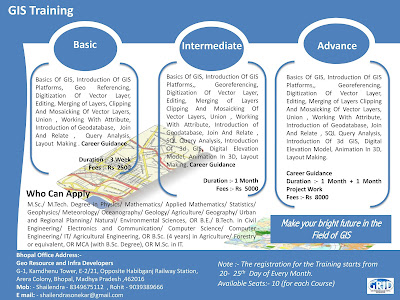
Note :- Short Term GIS and Remote Sensing Training in Available in Bhopal Madhya Pradesh.. 

For More Details please call : Mr Shailendra Sonekar (8349675112)
----------------------------------------------------------------------------------------------------------------------------------------------


GIS Specialist SOFTA GEOTECHNICAL PVT LTD


GIS Specialist SOFTA GEOTECHNICAL PVT LTD 700064

20,000 - 25,000 a month

Job Summary
·        URGENTLY Wanted GIS Executive to be posted in Assam.

Location- Assam
·        Experience- minimum 5 yrs

Qualification-
·        Post Graduate Diploma in Remote Sensing & GIS / MSc in Geoinformatics.

Software Knowledge:
·        Well conversant with AutoCAD, ArcGIS. Knowledge of TNTMips preferable.
·        Should have knowledge in DBMS / RDBMS
·        Knowledge of Web GIS will be added advantage.
Experience- 5 years
·        Interested candidate may call 8617587245, 9836884111, 7980703109. (Mon to Friday 11 am to 7 pm and Saturday 11 am to 5 pm).

Responsibilities and Duties
·        Software to be used- TNT Mips and AutoCAD
·        Topological Survey data incorporation and Digitization at client end
·        Geo Referencing
·        Creation, Addition, editing of maps / drawings
·        Preparation of land map / layout

Experience- 5 yrs

Required Experience, Skills and Qualifications

Software Knowledge:
·        Well conversant with AutoCAD, ArcGIS. Knowledge of TNTMips preferable.
·        Should have knowledge in DBMS / RDBMS
·        Knowledge of Web GIS will be added advantage.

Benefits
·        Free Lodging accommodation at Assam.
·        Fooding will be optional.

Job Type: Full-time
Salary: 20,000.00 to 25,000.00 /month

Experience:
GIS: 5 years (Required)

Education:
Bachelor's (Required)

Mail CV at- contact@softageo.com ; bijonsofta@gmail.com

--------------------------------------------------------------------------------------------------------------
Note :- Short Term GIS and Remote Sensing Training in Available in Bhopal Madhya Pradesh.. 

For More Details please call : Mr Shailendra Sonekar (8349675112)
-----------------------------------------------------------------------------------------------------------------------------------------------


GIS Digitization EngineerQuantum Asia-Jaipur, Rajasthan


GIS Digitization EngineerQuantum Asia-Jaipur, Rajasthan

Required Skills:
Experience in GIS data handling/ Digitization tools like Arc Info, Arc Editor, ArcView, Auto CAD, MapInfo etc. Exposure to Digital Image Interpretation and spatial data conversion.

Qualifications:
Graduate in Maths, Science, Geography, Geology, Environmental Science or Computer Applications/ Diploma in Engineering.

Experience Required: 1- 3 years

Job Location: Jaipur

Email : contacthr@quantumasia.in


---------------------------------------------------------------------------------------------------------------
Note :- Short Term GIS and Remote Sensing Training in Available in Bhopal Madhya Pradesh..
-----------------------------------------------------------------------------------------------------------------------------------------------

GIS Operators with programmatic and Remote Sensing Experience.


GIS Operators with programmatic and Remote Sensing Experience.
SKP Projects Pvt Ltd.-390013

15,000 - 22,000 a month

Job Summary
Should have the experience in GIS, Photogrammetric and Remote Sensing areas.

Job Type: Full-time
Salary:   15,000.00 to 22,000.00 /month

Experience:
work: 1 year (Preferred)

Education:
Diploma (Preferred)


---------------------------------------------------------------------------------------------------------------
Note :- Short Term GIS and Remote Sensing Training in Available in Bhopal Madhya Pradesh..
-----------------------------------------------------------------------------------------------------------------------------------------------

Tuesday, December 26, 2017

Scientist in State Forest Research Institute Jabalpur, Madhya Pradesh


Scientist
State Forest Research Institute Jabalpur - Jabalpur, Madhya Pradesh

State Forest Research Institute Jabalpur Jobs 2017: 04 Scientist Vacancy for Array Salary 39,100 published on 26th December 2017. On 26/12/2017,

State Forest Research Institute Jabalpur announced Job notification to hire candidates who completed Array for the position of Scientist. . Vacancy 1 : Scientist Qualification : Any Post Graduate,
M.Phil/Ph.D Vacancies : 04 posts

Salary : Rs. 15,600 - Rs. 39,100 Per Month

Experience : 5 - 7 years

Job Location : Jabalpur

Last Date to Apply : 28/02/2018

Essential Qualification & Desirable Qualification:

a. Animal Ecology and Conservation Biology Post - 01: Masters Degree in Forestry/ Wildlife Science/ Life Science/Environmental Science with minimum 60% marks from recognized university. Minimum five Years experience in the field of predator and prey monitoring. - Ph.D. in relevant field. Knowledge on modem advanced population monitoring & relevant software.

b. Landscape level Planning and Management Post - 01: Masters Degree in Forestry! Wildlife Science/ Life Science/Environmental Science with minimum 60% marks from recognized university. Minimum five years experience in the field of landscape ecology. Ph.D. in relevant field. Experience in landscape planning/ Remote Sensing and GIS.

c. PA Network, Wildlife Management and Conservation Education Post 01: Masters Degree in Forestry/Wildlife Science/ Veterinary Science!Life Science/Environmental Science with minimum 60% marks from recognized university. Minimum five years experience in the field of wildlife management. - Ph.D. in relevant field. Experience in wildlife handling and conservation education.

d. Remote Sensing and GIS (GIS Analyst) Post - 01: Masters Degree in Forestry/Wildlife Science/Life Science/Environmental Science/ Remote Sensing and GIS/Geo-informatics with minimum 60% marks from recognized university. Minimum five years experience in the field of Remote Sensing and GIS. - Ph.D. in relevant field. PG Diploma in Remote Sensing & GIS from recognized institute/university. Experience in advanced Remote Sensing and GIS software for wildlife monitoring.Address.

State Forest Research Institute Jabalpur, Bhim Nagar, Polipather, Jabalpur, Madhya Pradesh 482008 Selection Procedure : Selection Will be Based either Written Exam/Interview

How to Apply: Interested Candidates can apply on or before 28/2/2017

for more details please visit the following link :

http://mpsfri.org/files/SFRI_Advt_Application.pdf


---------------------------------------------------------------------------------------------------------------
Note :- Short Term GIS and Remote Sensing Training in Available in Bhopal Madhya Pradesh..
-----------------------------------------------------------------------------------------------------------------------------------------------

Sunday, April 9, 2017

GIS and remote sensing Execuitives in ADCC Infocad Ltd.

3 to 5 Yrs in Hyderabad

Job Description
Proficiency with MapInfo/ArcGIS/AutoCAD etc.
Experience in creating GIS thematic layers related to Land Information System and Municipal GIS will be given preference and other spatial data related issues and opportunities. 

Experience with Microsoft Office Applications - Excel, Access, Word, Powerpoint etc.
Demonstrated experience using ESRI ArcGIS to develop, edit, and maintain spatial data from engineering as-built drawings.

Functional Area: Back Office Operations Industry: IT - Software Other Skills: Land Information System Word

 Recruiter details Company Name: ADCC Infocad Ltd.Company Description: 
ADCC Infocad incorporate in 1998 is a Meghe Group Company.
ADCC  incorporated in 1998, is a central India based Engineering and IT services company providing “Total Solution” in Geographical Information System (GIS), Photogrammetry, Engineering Design Services, Software Development and Energy System and Solutions in India and abroad.ADCC  caters to the GIS and Engineering industry and has emerged as Global Premier Software Solution Provider through its Alliances with World Leaders like Autodesk Inc. USA world’s biggest Design Content company, MathWorks, Dassault Systemes, Intergraph,  Siemens, Digital Globe,  Adobe, Corel, Sanako, Microsoft, HP & Tally.
 ADCC has been recently appointed as PAN INDIA Distributor/Reseller for Trimble-Building Construction Division for Education business..ADCCAcademy is the training Arm of ADCC for knowledge sharing in the fields of GIS, Remote Sensing and  Engineering & Design Software.  Besides  Academy also imparts various soft skill trainings in collaboration with DCTI, Mumbai and preparing students for various competitive exams.ADCC has emerged as Partner-of-Choice for leading Indian companies and Government sector.  Our project teams seamlessly integrate into our client project development team and environment and act as a virtual extension of their GIS and Engineering enterprise solutionsBased in Nagpur with branch offices in Mumbai, Pune, Hyderabad,  Ahmedabad, Lucknow and overseas offices in Africa-  Nairobi (Kenya) and|  Accra (Ghana)the company boasts the  state of  art infrastructure in Nagpur admeasuring 15,000 sq ft  with ultra modern IT Systems for Data Security and Integrity.ADCC is  CRISIL rated and NASSCOM & ASSOCHAM registered IT/ITES company.ADCC is empanelled with various Govt. Bodies for providing Services & Software Solutions. A MOU has been signed as GIS Technology Partner with Regional Center of Mapping of Resources for Development (RCMRD), Kenya, which is an inter-governmental organization and currently has 18 contracting Member States in the Eastern and Southern Africa Regions.AI Instruments Pvt. Ltd. it's a part of Meghe Group. Meghe group is a conglomerate, which has varied interests in the fields of Basic and Professional Education, Training, Hospitals, Industries & Estates, Banking, Information Technology, Media & Entertainment etc. based out of Nagpur for last three decades.

 Email: nilesh.d@adccinfocad.com

Telephone: 7123014305

--------------------------------------------------------------------------------------------------------------
Note :- Short Term GIS and Remote Sensing Training in Available in Bhopal Madhya Pradesh..
-----------------------------------------------------------------------------------------------------------------------------------------------


Saturday, February 11, 2017

GIS Engineer Bangalore

GIS Engineer
Nakshatech Pvt ltd.
Posted on 24-Jan-2017
1 to 4 Yrs Bangalore

Skills: Remote SensingGIS

Job Description
Utility & Gas Forestry Land Administration

Transportation Naksha tech has successfully implemented large projects for private and government organizations.
We use standardized business practices, coupled with software engineering processes, in all our ventures.
Naksha tech is well equipped to provide the full range of services in GIS, Remote Sensing, LIDAR data processing, Orthophoto, Laser scanning and digital Photogrammetry.

Experience: - Minimum 1 to 4 year experience GIS Engineer is Required.
This is an urgent vacancy so candidates looking for job, would have to personally meet you for a discussion at the following address.We value your interest in joining with the team of professionals in our organization.

Functional Area: General / Other Software Industry: Recruitment Services Skills: Remote Sensing GIS Other Skills: LIDAR data processing Laser scanning Orthophoto

 Recruiter details Company Name: Nakshatech Pvt ltd.Company Description:
Nakshatech Private Limited – Bangalore, Karnataka

Job Discription: We currently have a range of opportunities for Photogrammetrist to join our team in Nakshatech, Karnataka, India. Our project portfolio includes photogrammetric mapping for a wide variety of clients and we also welcome applications Photogrammetric technicians looking to develop photogrammetric skills.

Email: hr@nakshatech.com
Telephone: 8026600028


--------------------------------------------------------------------------------------------------------------
Note :- Short Term GIS and Remote Sensing Training in Available in Bhopal Madhya Pradesh..
-----------------------------------------------------------------------------------------------------------------------------------------------


Thursday, October 13, 2016

Walk-in for GIS Profile from 20th-22nd October from 10 AM-1 PM mapmyindia, Delhi, Delhi

Walk-in for GIS Profile from 20th-22nd October from 10 AM-1 PM 
mapmyindia Delhi, Delhi

We are looking for freshers and experienced candidates who are looking for job in GIS profile.

The role will involve the following responsibilities: 
Regular categorization of information, Data Formatting and cleaning.
Data Geometry Verification.
Data Verification and validation using internet & other sources.
Should be efficient in MS Access, Office, Excel, and PowerPoint.
Good communication skills.
Should be a graduate.

The candidates who have already appeared for the interview within 6 months are not eligible.

Kindly go through the company profile before appearing for the interview.

Venue: 
MapmyIndia
CE Info Systems Pvt Ltd
Plot No-68, Okhla Phase-3,
Nearest metro- Govindpuri
New Delhi.

Time- 10 AM- 1 PM 

Salary: Not Disclosed by Recruiter

Keyskills: Excel Powerpoint MS Access Internet gis gis executive gis engineer arcgis georeferencing digitization data extraction

Desired Profile 

Education: UG -Any Graduate - Any Specialization, Graduation Not Required
PG - Any Postgraduate, Post Graduation Not Required
Doctorate - Any Doctorate - Any Specialization, Doctorate Not Required

--------------------------------------------------------------------------------------------------------------
Note :- Short Term GIS and Remote Sensing Training in Available in Bhopal Madhya Pradesh.
-----------------------------------------------------------------------------------------------------------------------------------------------


RS Specialist Spatial Decisions is hiring RS Specialist for its office based in Delhi.

RS Specialist
Spatial Decisions is hiring RS Specialist for its office based in Delhi. GIS/ RS Specialist to handle technical delivery, mentor junior team members, interact with external project team members and client agencies, prepare project progress reports. Must be conversant with GIS/ RS/ WebGIS technologies.


Name of the post – RS Specialist

Total vacancies – 1

Qualification(s): Any Graduate – Any Specialization. Post Graduation & Doctorate Not Required.

Salary: Rs. 3,50,000 – 7,00,000 P.A

Experience: 5-10 years.

Other Desired skills: GIS/ RS Specialist with international education and strong technical skills. WebGIS highly desirable.Willing and able to work in domestic and international marketplace in SE Asia.

Wednesday, October 12, 2016

GIS Associate/Sr. GIS Associate/Team Lead Dimension India Networks - Delhi, Delhi

GIS Associate/Sr. GIS Associate/Team Lead 
Dimension India Networks - Delhi, Delhi

Skills:

Ability to deliver high quality work in GIS projects with specialization in Telecom.

Qualification:
Graduate or GIS/ CAD certified.

Profile:
To Design, Digitize and Create deliverables using various CAD GIS platforms for wide range of GIS, Telecom, Urban Design and Infrastructural Projects.

Experience:
1-6 Years

---------------------------------------------------------------------------------------------------------------
Note :- Short Term GIS and Remote Sensing Training in Available in Bhopal Madhya Pradesh..
-----------------------------------------------------------------------------------------------------------------------------------------------


State Engineer GIS Reliance Jio Infocomm Limited Guwahati, Assam

State Engineer GIS 
Reliance Jio Infocomm Limited Guwahati, Assam
Job Responsibilities :
1. Mapping of features from various sources to the requirement of
the Organization by working on various GIS platforms.
2. Geographical analysis of available locations.
3. Analysis of gathered data.
4. Find out the connectivity between sites.

Education Requirement : BE

Experience Requirement :
3-8 Years

Skills & Competencies :
1. Understanding of Basic GIS Architecture.
2. Object Oriented Programming, Web services Knowledge, GIS Workflow,
Metadata creation & editing.

--------------------------------------------------------------------------------------------------------------
Note :- Short Term GIS and Remote Sensing Training in Available in Bhopal Madhya Pradesh..
-----------------------------------------------------------------------------------------------------------------------------------------------

Saturday, October 1, 2016

JRF Geology Pondicherry University Puducherry, Puducherry

JRF Geology 
Pondicherry University  Puducherry, Puducherry

Ref. No: PU/ES/KNK/Ch-1-AO/2016/JRF/01, Date : 28.09.2016

JRF Geology Job Position in Pondicherry University

Project Title :

1. A morphological and Compositional Analysis of selected Geochemical Anomalous Regions on Moon Using Chandrayaan-1 and other lunar datasets”

2. An integrated Morphological & Spectral Analysis of Shalbatana Vallis and its surrounding region on ars using MOM-MCC data and other international datasets”

Qualification : 1. M.Sc in Geology/Applied geology/Earth Sciences/Equivalent degrees with minimum 55% marks and a valid GATE/NET Score; 2. M Tech in Remote Sensing/Geoinformatics with sound knowledge of geology.

Fellowship : Rs. 25,000/- for first two years and Rs.28,000/- for third year after assessment.


---------------------------------------------------------------------------------------------------------------
Note :- Short Term GIS and Remote Sensing Training in Available in Bhopal Madhya Pradesh..
-----------------------------------------------------------------------------------------------------------------------------------------------


Walk in for 50 Project Staff Walk-In NGRI Recruitment 2016 –

Walk in for 50 Project Staff 
Walk-In
NGRI Recruitment 2016 – 

Walk in for 50 Project Staff Posts: CSIR-National Geophysical Research Institute (NGRI), Hyderabad has published a notification for the recruitment of 50 Project Assistant & Project Associate vacancies on temporary basis under various projects. Eligible candidates can attend for walk in interview on 04-10-2016 from 08:30 AM onwards. Other details like age limit, educational qualification, selection process & how to apply are given below…

NGRI Vacancy Details: 
Total No of Posts: 50
Name of the Posts:
1. Project Assistant I: 09 Posts
2. Project Assistant II: 28 Posts
3. Project Assistant III: 09 Posts
4. Research Associate I: 03 Posts
5. Research Associate III: 01 Post

Age Limit: Candidates age limit should be 28 years for S.No-01, 30 years for S.No-02, 35 years for S.No-03 to 05 as on date of interview. Age relaxation will be applicable 05 years for SC/ ST/ OBC/ PWD and Women candidates.

Educational Qualification: Candidates should have B.Sc for S.No-01, M.Sc in Geology, Geophysics, Applied Geology, Hydrology, Environmental Science for S.No-02, M. Sc./ M. Tech in Geology/ Applied Geology/ Geophysics, Remote Sensing/ GIS with not less than 55% of marks plus 2 years of experience in the relevant field for S.No-03, Ph.D in Hydrology/ Geology, Geophysics, Science for S.No-04 & 05. For more details refer the notification.

Selection Process: Shortlisted candidates will be called for interview.

How to Apply: Eligible candidates can registered through the website www.ngri.org.in on or before 30-09-2016 at 06:00 PM & attend for walk in interview along with originals and one set of certificates of educational qualification, age, caste (in case of SC/ ST/ OBC candidates), one recent passport size photo etc., on 04-10-2016 from 08:30 AM onwards. Venue details are mentioned below.

Important Dates: 

Last Date for Online Registration
30-09-2016 at 06:00 PM

Date of Displaying Shortlisted Candidates on CSIR-NGRI Website
01 or 02-10-2016

Date & Time of Interview
04-10-2016 from 08:30 AM onwards

Venue
CSIR-National Geophysical Research Institute, Uppal Road, Hyderabad-500007

---------------------------------------------------------------------------------------------------------------
Note :- Short Term GIS and Remote Sensing Training in Available in Bhopal Madhya Pradesh..
-----------------------------------------------------------------------------------------------------------------------------------------------

Tuesday, September 27, 2016

Senior Geospatial Modeler Model Development/Modeling | RMS Noida, India

Senior Geospatial Modeler

Model Development/Modeling | Noida, India 

Senior Modeler- Geospatial

Overview of the role

Develop geocoding data sets for RMS software applications.  Translate GIS data sets from third party vendors, GIS maps of address information into Geodatabase that help locate client properties for catastrophe risk modeling.  Assist in developing new GIS spatial and attribute data in support of geocoding and modeling.  Review and compare third-party maps and data for technical suitability.

Maintain the quality of RMS geocoding data.  Draft clear, detailed and reproducible test plans.  Execute diagnostic tests and evaluate their results using database applications and RMS software, especially RiskLink.  Collaborate with colleagues from throughout the company (including model developers, product managers, and software engineers) and in RMS offices around the world, to identify and fix geocoding data bugs.

Objectives for the role

Collect, compile, and manipulate GIS data in support of geocoding and hazard modeling.  Design, build, and test global spatial and attribute data of address information at multiple resolutions (streets, postal codes, cities, counties, states, and countries).  Help prepare and review technical documents for data development.  Build up expertise in addressing systems worldwide, and an understanding of how these relate to GIS data attributes.

Assist in monitoring the quality of all GIS and geocoding databases at RMS.  Design and perform “ground-truthing” exercises to validate the accuracy of base-map features.  Draft clear, detailed and reproducible test plans for evaluating map data.  Asses the quality of geocoding databases by executing tests and evaluating results using database applications especially Geodatabase and ESRI product applications and RMS software.  Collaborate with colleagues from throughout the company (including model developers, product managers, and software engineers) and in RMS offices around the world, to identify and fix map-data and geocoding bugs. 

Technical Skills:

Post Graduate in Geo-Informatics / Earth Sciences or Graduate in planning from a reputed institution
Minimum 5 plus years’ experience of working on projects related to geographical analysis, database management, cartographic design, geocoding or spatial modeling

Experience in design and development of GIS applications using ArcSDE Geodatabase.
Good knowledge of Geodatabase administration concepts such as versioning, reconciliation, replication to multiple GIS developers in an enterprise is a must.

Experience in .NET programming languages C#, scripting languages such Python, VB Script and programming experience using ArcSDE, ArcObjects is a must.

Good knowledge of databases like MS Access / Microsoft SQL Server. Experience with SQL programming is required.

Exposure to Arc GIS Desktop customization will be added advantage

Good understanding with Arc GIS and its extensions (Spatial Analyst)
The candidate must be detail-oriented and self-motivated, with excellent written and verbal communication skills, as well as a willingness and ability to learn in a fast-paced development environment

RMS:

Did you know there’s a 5% chance that a hurricane will cause $60 billion of insured losses next year?   And there’s a 1% chance that an earthquake will cause $50 billion of insured loss in the next 12 months?  We do.  At RMS, we build the simulation models that allow insurers and investors to understand portfolio risks due to catastrophes:  natural catastrophes (hurricane, earthquake, flood), terrorism, pandemic, and changes in life expectancy.

We are one of the most exciting and technologically sophisticated firms you’ve ‘never’ heard of, unless you’re one of our hundreds of clients in the (re)insurance, banking or hedge fund sector.  We lead an industry we helped pioneer and ultimately our work makes a true impact on the world at large.  How we understand and manage risk affects everybody and our passion is nothing less than creating a more resilient world through a better understanding of catastrophic events.

As we approach our 25th anniversary, we are now evolving our vision by delivering future solutions in the cloud, releasing in 2015 a cutting edge risk management platform ‘RMS(one)’ for the global risk market.  RMS(one) will create a holistic and integrated view across the enterprise with one platform for all models, all points of view, all data. All will be run as equal partners on RMS(one).
To find out more, visit www.rms.com.  ; Or follow us on Facebook or @rmsjobs on Twitter.

RMS is proud to be an equal opportunity employer.

Note :- Short Term GIS and Remote Sensing Training in Available in Bhopal Madhya Pradesh..
-----------------------------------------------------------------------------------------------------------------------------------------------


Survey Supervisior Nascent Info Technologies Pvt Ltd - Ahmedabad, Gujarat

Survey Supervisior 

Nascent Info Technologies Pvt Ltd - Ahmedabad, Gujarat

Gender - Male

Terms of appointment: Contractual
Period of appointment: 6 months which can be extended for another 3 months
Interact extensively with surveyor and internal team to understand validation process.
Analyze the process and provide day to day feedback to surveyor to improve quality of property tagging data.
Allotment of work to surveyor and receive the same after property tagging
Must know data validation process of property tagging
Must check and validate the property onsite along with surveyor at different location on daily basis. Also sign the property in database print for which validation is done
Updation of database and GIS map after validation
Conduct survey of manholes and streetlight using mobile application (Provided by Nascent)
Maintain log book of validated property on daily basis
Interact and report to concern authority for status and discrepancy.

Note :- Short Term GIS and Remote Sensing Training in Available in Bhopal Madhya Pradesh..
-----------------------------------------------------------------------------------------------------------------------------------------------

North Eastern Space Applications Centre, Scientist/ Engineer

North Eastern Space Applications Centre, Scientist/ Engineer
North Eastern Space Applications Centre (NESAC) - India
Salary :- 56,100 a month
North Eastern Space Applications Centre (NESAC) invites applications to recruit on vacant posts of Scientist/Engineer ‘SC’. Online applications against these Sarkari Naukri can be submitted on or before 25 October 2016.

NESAC Vacancy 2016 Details

1. Scientist/ Engineer ‘SC’ [Space & Atmospheric Science] – 01 Post
Age Limit: Not be more than 35 years as on 25.10.2016.
Qualification: M.Sc/M.Tech degree in Physics/ Atmospheric Science/ Earth System Science / Meteorology or equivalent.
Pay Scale: Rs.56,100/- Per Month

2. Scientist/Engineer ‘SC’ [Geoscience] – 1 Post
Qualification: M.Sc/M.Tech in Geology or equivalent.
Pay Scale: Rs.56,100/- Per Month
Age Limit: 35 years as on 25.10.2016

3. Scientist/Engineer ‘SC’ [Geoinformatics Applications] – 1 Post
Qualification: M.Sc/M.E/M.Tech in Remote Sensing & GIS / GeoInformatics/Geomatics or equivalent.
Pay Scale: Rs.56,100/- Per Month
Age Limit: 35 years as on 25.10.2016

4. Scientist/Engineer ‘SC’ [Urban Planning] – 1 Post
Qualification: M.Sc in Geography (Urban Planning/Regional Planning) OR M.Plan/M Tech (Planning) in Urban & Regional Planning with specialization in Urban & Regional Planning.

Pay Scale: Rs.56,100/- Per Month

Age Limit: 35 years as on 25.10.2016

How to Apply : Online Applications against these Sarkari Naukri should be submit through the website www.nesac.gov.in.

The Last Date to submit the applications is 25 October 2016 .

Note :- Short Term GIS and Remote Sensing Training in Available in Bhopal Madhya Pradesh..
-----------------------------------------------------------------------------------------------------------------------------------------------


Wednesday, August 10, 2016

NCRPB, Consultant (Urban/ Regional/ Infrastructure Planning) National Capital Region Planning Board (NCRPB), Lodhi Road - Delhi, Delhi

NCRPB, Consultant (Urban/ Regional/ Infrastructure Planning)

National Capital Region Planning Board (NCRPB), Lodhi Road - Delhi, Delhi

50,000 - 60,000 a month

National Capital Region Planning Board (NCRPB) invites applications to recruit on vacant posts of Consultant (Urban/Regional/ Infrastructure Planning). Applications against these Sarkari Naukri can be submitted on or before 19 Aug 2016.

NCRPB Vacancy 2016 Details

Name of the post – Consultant (Urban/Regional/ Infrastructure Planning)

Total vacancies – 2 Posts

Age Limit : Not be more than 40 years. Upper age limit shall be relaxed as per the rules.

Qualification(s) : Post Graduate Degree in Town or City or Urban or Infrastructure or Regional Planning. 2-4 years’ experience in projects relating to town & country planning preferably regional/urban planning or similar projects and evaluation of parameters for land use planning, environment, regional connectivity, development potential, socio-economic parameters, etc.

Desirable : Experience in Remote Sensing and Geographic Information System Application. Proficiency in data analysis/presentation and report preparation using MS-Office Programs and GIS etc. Associate membership of the Institute of Town Planners, India.

Pay Scale : Rs.50000-60000/- Per Month


How to Apply : Duly filled-in applications in prescribed application format along with copies of required documents should be reach to: Member Secretary, NCRPB, Core-4B, First Floor, India Habitat Center, Lodhi Road, New Delhi-110003 . The Last Date to submit application is 19 Aug 2016.

Note :- Short Term GIS and Remote Sensing Training in Available in Bhopal Madhya Pradesh.

 .
For more details please visit us at www.gridindia.org

Research Scientist Geophysics North Eastern Space Applications Centre - Shillong, Meghalaya

Research Scientist Geophysics
North Eastern Space Applications Centre - Shillong, Meghalaya
15,600 - 39,100 a month

Advertisement No. NESAC/01/2016
Research Scientist Hydrology Jobs recruitment in North Eastern Space Applications Centre
Project : Flood Early Warning Systems (FLEWS)

Research Scientist Hydrology / 01Post
Qualification: M.E/M.Tech (Water Resources/Hydrology) or M.Tech/M.Sc Remote Sensing (Hydrology) or equivalent
Desired Credentials : Experience in Water Resources/Hydrology area with working knowledge of HEC-HMS, FLO-2D, MIKE FLOOD, SWAT, RS & GIS, etc.

Research Scientist Meteorology/ 01 Post
Qualification : M.Sc/M.Tech in Physics / Meteorology/Atmospheric Science/Earth Systems Science or equivalent .
Desired Credentials: Experience and conversant with LINUX operating system and programming knowledge in MATLAB.
Project: Doppler Weather Radar (DWR),Cherrapunjee

Research Scientist Electronics & Electrical Engineering/ 02 Posts
Qualification : M.Tech in Electronics/ Electronics and Telecommunication Engineering/ Electronics design & Technology/Electrical Engineering or equivalent.
Desired Credentials: Experience and conversant with LINUX operating systems and programming knowledge in MATLAB.
Project: North Eastern Region Node for Disaster Risk Reduction (NER-DRR)

Research Scientist Information Technology /01 Post
Qualification : M.E/M.Tech in Computer Science/IT or equivalent.
Desired Credentials: Experience and knowledge in Geoserver, Mapserver, UML, XML, or open layers, Jquery and free/open source.

Research Scientist Geophysics / 01 Post
Qualification : M.Sc/ M.Tech in Geology Geophysics or equivalent .
Desired Credentials: 1) Experience in earthquake / landslide related work. 2) Additional degree/diploma in relevant field. 3) Working knowledge of GIS, Programming knowledge in MATLAB, IDL, FORTRAN, etc.

Research Scientist Atmospheric Science /01 Post
Qualification : M.Sc in Physics/Atmospheric Science/Meteorology or M.Tech in Earth System Science or equivalent.
Desired Credentials : 1) Experience in meteorology / atmospheric science or relevant field. 2) Knowledge in LINUX OS, programming in MATLAB, IDL, FORTRAN, etc.

Research Scientist Environment /01Post
Qualification : M.Sc in Environmental Sciences/Forestry/Ecology/Bo tany/Geography or equivalent. Desired Credentials: Experience on air pollution/ climate change studies, etc. 2) Knowledge on Remote Sensing and GIS programming.

Research Scientist RS & GIS /02 Posts
Qualification : M.Sc/M.Tech in RS&GIS/ Geoinformatics from a recognized university or equivalent.
Desired Credentials: Experience in microwave remote sensing/photogrammetry / hyperspectral/LIDAR data analyst, etc.

Research Scientist Communication Support /01Post
Qualification : M.E/M.Tech in Electronics & Communication Engineering or equivalent.
Experience in satellite communication based system / application projects.
Pay Scale: Rs.15600- 39100

Note: 1 Number of positions indicated above are provisional and may vary depending on the actual requirement. 2 ME/M.Tech/MSc or its equivalent degree should be in first class with an aggregate minimum of 65% or CGPA/CPI grading of 6.5 on a 10 scale or equivalent. Rounding-off marks is not allowed.

Age Limit: 35 years as on 09.09.2016 (40 years in case of SC/ST candidates and 38 years for OBC candidates).

Pay & Allowances: Selected candidates will be offered the fellowship as Research Scientist in the Pay Band of '15600-39100 with Grade Pay ' 5400/-. The gross emoluments in the minimum of Pay Band will at present be approximately ' 47250/-. In addition HRA at the prescribed rates in force at the place of posting will be paid.


Selection Process: The qualifications prescribed in this advertisement are the minimum requirement and the same does not automatically make candidates eligible to be called for interview. Based on the experience and details of marks furnished by the applicants, the candidates will be shortlisted for interview..

-----------------------------------------------------------------------

Note :- Short Term GIS and Remote Sensing Training in Available in Bhopal Madhya Pradesh..


For More details Please Visit us at www.gridindia.org

Monday, July 25, 2016

Telecommunication and Electronics Trigent Software Limited - Mumbai, Maharashtra

Telecommunication and Electronics 

Trigent Software Limited  - Mumbai, Maharashtra

₹2,00,000 - ₹3,00,000 a year

No. of Job opening               1

Functional Area Other 

Industry Type IT-Software/Software Services
Keywords Networking, Telecom, Telecommunication, Electronics, GIS, GPS, Network Design
Freshers -1 year experience in telecommunication and electronics.

Work profile is basically GIS , Network design .

Knowledge of Telecom Infrastructure / Electrical Infrastructure / Network Topology / GPS data.

Good communication is must.

Desired Candidate Profile Profile Description
NA

Under Graduate Qualification

PG Qualifications Any PG Course (Any Specialization)

*Note: Candidate should have either UG or PG qualifications

---------------------------------------------------------------------------------------
Note :- Short Term GIS and Remote Sensing Training in Available in Bhopal Madhya Pradesh..


GIS Digitization Engineer Quantum Asia Pvt Ltd. - Jaipur, Rajasthan

GIS Digitization Engineer 

Quantum Asia Pvt Ltd. - Jaipur, Rajasthan
Experience in GIS data handling/ Digitization tools like Arc Info, Arc Editor, ArcView, Auto CAD, MapInfo etc. Exposure to Digital Image Interpretation and spatial data conversion
Graduate in Maths, Science, Geography, Geology, Environmental Science or Computer Applications/ Diploma in Engineering.
Experience Required: 1-3 Years.
Job Type: Full-time
Job Location:
  • Jaipur, Rajasthan
Required education:
  • Bachelor's
Required experience:
  • GIS: 3 years

==============================================
Note :- Short Term GIS and Remote Sensing Training in Available in Bhopal Madhya Pradesh..