Senior Geospatial Modeler
Model Development/Modeling | Noida, India
Senior Modeler- Geospatial
Overview of the role
Model Development/Modeling | Noida, India
Senior Modeler- Geospatial
Overview of the role
Develop geocoding data sets for RMS software applications. Translate GIS data sets from third party vendors, GIS maps of address information into Geodatabase that help locate client properties for catastrophe risk modeling. Assist in developing new GIS spatial and attribute data in support of geocoding and modeling. Review and compare third-party maps and data for technical suitability.
Maintain the quality of RMS geocoding data. Draft clear, detailed and reproducible test plans. Execute diagnostic tests and evaluate their results using database applications and RMS software, especially RiskLink. Collaborate with colleagues from throughout the company (including model developers, product managers, and software engineers) and in RMS offices around the world, to identify and fix geocoding data bugs.
Objectives for the role
Collect, compile, and manipulate GIS data in support of geocoding and hazard modeling. Design, build, and test global spatial and attribute data of address information at multiple resolutions (streets, postal codes, cities, counties, states, and countries). Help prepare and review technical documents for data development. Build up expertise in addressing systems worldwide, and an understanding of how these relate to GIS data attributes.
Assist in monitoring the quality of all GIS and geocoding databases at RMS. Design and perform “ground-truthing” exercises to validate the accuracy of base-map features. Draft clear, detailed and reproducible test plans for evaluating map data. Asses the quality of geocoding databases by executing tests and evaluating results using database applications especially Geodatabase and ESRI product applications and RMS software. Collaborate with colleagues from throughout the company (including model developers, product managers, and software engineers) and in RMS offices around the world, to identify and fix map-data and geocoding bugs.
Technical Skills:
Post Graduate in Geo-Informatics / Earth Sciences or Graduate in planning from a reputed institution
Minimum 5 plus years’ experience of working on projects related to geographical analysis, database management, cartographic design, geocoding or spatial modeling
Experience in design and development of GIS applications using ArcSDE Geodatabase.
Good knowledge of Geodatabase administration concepts such as versioning, reconciliation, replication to multiple GIS developers in an enterprise is a must.
Experience in .NET programming languages C#, scripting languages such Python, VB Script and programming experience using ArcSDE, ArcObjects is a must.
Good knowledge of databases like MS Access / Microsoft SQL Server. Experience with SQL programming is required.
Exposure to Arc GIS Desktop customization will be added advantage
Good understanding with Arc GIS and its extensions (Spatial Analyst)
The candidate must be detail-oriented and self-motivated, with excellent written and verbal communication skills, as well as a willingness and ability to learn in a fast-paced development environment
RMS:
Did you know there’s a 5% chance that a hurricane will cause $60 billion of insured losses next year? And there’s a 1% chance that an earthquake will cause $50 billion of insured loss in the next 12 months? We do. At RMS, we build the simulation models that allow insurers and investors to understand portfolio risks due to catastrophes: natural catastrophes (hurricane, earthquake, flood), terrorism, pandemic, and changes in life expectancy.
We are one of the most exciting and technologically sophisticated firms you’ve ‘never’ heard of, unless you’re one of our hundreds of clients in the (re)insurance, banking or hedge fund sector. We lead an industry we helped pioneer and ultimately our work makes a true impact on the world at large. How we understand and manage risk affects everybody and our passion is nothing less than creating a more resilient world through a better understanding of catastrophic events.
As we approach our 25th anniversary, we are now evolving our vision by delivering future solutions in the cloud, releasing in 2015 a cutting edge risk management platform ‘RMS(one)’ for the global risk market. RMS(one) will create a holistic and integrated view across the enterprise with one platform for all models, all points of view, all data. All will be run as equal partners on RMS(one).
To find out more, visit www.rms.com. ; Or follow us on Facebook or @rmsjobs on Twitter.
RMS is proud to be an equal opportunity employer.
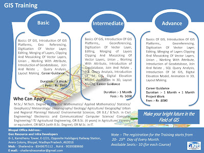
Note :- Short Term GIS and Remote Sensing Training in Available in Bhopal Madhya Pradesh..
-----------------------------------------------------------------------------------------------------------------------------------------------