JRF Geology
NRSC- Hyderabad,
Andhra Pradesh
Salary - 25,000 a month
Advt
No.NRSC/RMT/5/2016 19.05.2016
JRF Geology
recruitment in National Remote Sensing Centre (NRSC-ISRO)
Post Code : I
Qualification
: ME/M.Tech/M.Sc.(Tech) in Geology / Geophysics / Remote Sensing after B.E /
B.Tech / M.Sc. (OR) M.Sc in Geology / Remote Sensing & GIS with NET or
equivalent qualification
No. of Post
: 01
Post Code : II
Qualification
: M.E / M.Tech in Meteorology / Climatology / Atmospheric Sciences / Remote
Sensing after B.E. / B.Tech. / M.Sc. (OR) M.Sc. in Physics/ Meteorology/
Climatology / Atmospheric Sciences / Remote Sensing & GIS with NET or
equivalent qualification
No. of Post
: 01
Post Code : III
Qualification
: M.Sc. (Agriculture) in Soil Science/Agricultural Chemistry & Soil
Science/Agronomy(with Soil Science as a subject) with ICAR-NET or equivalent
qualification (OR) ME/M.Tech in Remote Sensing & GIS/ Geo-Informatics.
Desirable Qualification: Working knowledge in Soil sampling and Analysis /
spatial data analysis.
No. of Post
: 01
Post Code : IV
Qualification
: ME/M.Tech in Remote Sensing / Remote Sensing & GIS /Geo-Informatics and
Remote Sensing / Geoinformatics. Desirable Qualification: Knowledge in
programming languages such as MATLAB, Python, Open CV and CNL etc, Satellite
Image Analysis, Interpretation and GIS.
No. of Post
: 03
Post Code : V
Qualification
: M.E. / M.Tech in Meteorology/ Atmospheric Sciences / Remote Sensing & GIS
after B.E. / B. Tech / MSc (Or) (a) M.Sc in Physics/ Meteorology/ Atmospheric
Sciences with NET or Equivalent. & (b) M.Sc degree holders must have
studied Mathematics & Chemistry at graduation level. Desirable
Qualification: Computer programming skills in Fortran / C or any high level
language and Aptitude for working in Atmospheric Sciences.
No. of Post
: 02
Post Code : VI
Qualification
: ME/M.Tech in Geomatics / Geoinformatics after BE/B.Tech in Civil / Computer
Science/Electronics. Desirable Qualification: Skills in C/C++, Java and Python
programming languages
No. of Post
: 01
Post Code : VII
Qualification
: M.Sc. (Agriculture) in Agricultural Chemistry & Soil Science / Agronomy
(with soil science as a subject) with ICAR-NET/equivalent qualification.
Desirable Qualification: Knowledge in Soil Analysis / Geoinformatics / Spatial
data analysis.
No. of Post
: 01
Post Code : VIII
Qualification
: M.E. / M.Tech in Water Resources / Hydrology / Environmental Engineering
after B.E. / B.Tech in Civil / Environmental Engineering.
No. of Post
: 01
Post Code : IX
Qualification
: M.E. / M.Tech in Water Resources / Hydrology / Hydraulics Engineering after
B.E. / B.Tech in Civil / Environmental Engineering
No. of Post
: 02
Post Code : X
Qualification
: ME/M.Tech in Remote Sensing / Geoinformatics / Environmental Geoinformatics
after B.Sc (Agriculture) /B.Tech in Agriculture / Civil Engineering / M.Sc in
Agriculture/Physics.
No. of Post
: 01
Place of
Posting : For Post Nos: I, II & III shall be at Jodhpur and for Post No:
VII at Nagpur. For the balance posts the place of posting is Hyderabad. The
JRFs posted at Hyderabad shall also be liable to serve at NRSC Earth Station,
Shadnagar campus, Mahabubnagar Dt. if a need arises. The selected candidates
shall also be liable to be posted anywhere in India based on project
requirements.
Emoluments :
Consolidated pay of Rs.25,000/- plus applicable HRA thereon if hostel facility
is not provided at the station. The present rates of HRA is 30% for Hyderabad
and 20% for Jodhpur & Nagpur.
Age Limit :
Maximum Age Limit of 28 years
Selection
Process : Being Posts assigned for conducting and guiding research, selection
shall be 100% by Merit. Candidates shortlisted based on % of marks shall be
called for Interview at Hyderabad tentatively scheduled in June, 2016. Call
letters for Interview shall be sent by e-mail to short-listed candidates. The
list of short-listed / finally selected candidates shall be hosted at NRSC
website. Interview : Candidates called for Interview shall be reimbursed to and
fro Sleeper Class train fare by the shortest route against submission of a copy
of train ticket / e-ticket print-out. Candidates should submit for verification
all Original certificates in proof of Educational Qualification (Class X
onwards) along with one set of self-attested photocopies. Semester/year-wise
mark-sheets should also be produced apart from Consolidated Mark Sheets and
Provisional/Final Degree Certificates.
-----------------------------------------------------------------------------
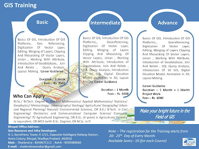
Note :- Short Term GIS and Remote Sensing Training in Available in Bhopal Madhya Pradesh..