Showing posts with label GIS Executive. Show all posts

Friday, January 11, 2019

GIS Engineer in Chemin Conceptions Pvt. Ltd.-Bhubaneshwar, Orissa


GIS Engineer
Chemin Conceptions Pvt. Ltd.-Bhubaneshwar, Orissa

Job Summary
GIS Expert with 05 years of post qualification experience

Responsibilities and Duties
·        Must have experience in working with GIS based tools such as ArcGIS Desktop/Online
·        Experience and knowledge in any Open source GIS map tools
·        Conducting GPS and DGPS surveys and digitization of the same
·        Required Experience, Skills and Qualifications

Degree in Geography, Planning, Architecture with Diploma/ Certificate in GIS
At least 5 years of experience in working on similar projects (i.e. use of remote sensing & GIS technology in urban sector projects).

Job Type: Full-time

Experience:
GIS Engineer: 5 years (Preferred)

Education:
Bachelor's (Preferred)

Sunday, April 9, 2017

GIS and remote sensing Execuitives in ADCC Infocad Ltd.

3 to 5 Yrs in Hyderabad

Job Description
Proficiency with MapInfo/ArcGIS/AutoCAD etc.
Experience in creating GIS thematic layers related to Land Information System and Municipal GIS will be given preference and other spatial data related issues and opportunities. 

Experience with Microsoft Office Applications - Excel, Access, Word, Powerpoint etc.
Demonstrated experience using ESRI ArcGIS to develop, edit, and maintain spatial data from engineering as-built drawings.

Functional Area: Back Office Operations Industry: IT - Software Other Skills: Land Information System Word

 Recruiter details Company Name: ADCC Infocad Ltd.Company Description: 
ADCC Infocad incorporate in 1998 is a Meghe Group Company.
ADCC  incorporated in 1998, is a central India based Engineering and IT services company providing “Total Solution” in Geographical Information System (GIS), Photogrammetry, Engineering Design Services, Software Development and Energy System and Solutions in India and abroad.ADCC  caters to the GIS and Engineering industry and has emerged as Global Premier Software Solution Provider through its Alliances with World Leaders like Autodesk Inc. USA world’s biggest Design Content company, MathWorks, Dassault Systemes, Intergraph,  Siemens, Digital Globe,  Adobe, Corel, Sanako, Microsoft, HP & Tally.
 ADCC has been recently appointed as PAN INDIA Distributor/Reseller for Trimble-Building Construction Division for Education business..ADCCAcademy is the training Arm of ADCC for knowledge sharing in the fields of GIS, Remote Sensing and  Engineering & Design Software.  Besides  Academy also imparts various soft skill trainings in collaboration with DCTI, Mumbai and preparing students for various competitive exams.ADCC has emerged as Partner-of-Choice for leading Indian companies and Government sector.  Our project teams seamlessly integrate into our client project development team and environment and act as a virtual extension of their GIS and Engineering enterprise solutionsBased in Nagpur with branch offices in Mumbai, Pune, Hyderabad,  Ahmedabad, Lucknow and overseas offices in Africa-  Nairobi (Kenya) and|  Accra (Ghana)the company boasts the  state of  art infrastructure in Nagpur admeasuring 15,000 sq ft  with ultra modern IT Systems for Data Security and Integrity.ADCC is  CRISIL rated and NASSCOM & ASSOCHAM registered IT/ITES company.ADCC is empanelled with various Govt. Bodies for providing Services & Software Solutions. A MOU has been signed as GIS Technology Partner with Regional Center of Mapping of Resources for Development (RCMRD), Kenya, which is an inter-governmental organization and currently has 18 contracting Member States in the Eastern and Southern Africa Regions.AI Instruments Pvt. Ltd. it's a part of Meghe Group. Meghe group is a conglomerate, which has varied interests in the fields of Basic and Professional Education, Training, Hospitals, Industries & Estates, Banking, Information Technology, Media & Entertainment etc. based out of Nagpur for last three decades.

 Email: nilesh.d@adccinfocad.com

Telephone: 7123014305

--------------------------------------------------------------------------------------------------------------
Note :- Short Term GIS and Remote Sensing Training in Available in Bhopal Madhya Pradesh..
-----------------------------------------------------------------------------------------------------------------------------------------------


Monday, July 25, 2016

Telecommunication and Electronics Trigent Software Limited - Mumbai, Maharashtra

Telecommunication and Electronics 

Trigent Software Limited  - Mumbai, Maharashtra

₹2,00,000 - ₹3,00,000 a year

No. of Job opening               1

Functional Area Other 

Industry Type IT-Software/Software Services
Keywords Networking, Telecom, Telecommunication, Electronics, GIS, GPS, Network Design
Freshers -1 year experience in telecommunication and electronics.

Work profile is basically GIS , Network design .

Knowledge of Telecom Infrastructure / Electrical Infrastructure / Network Topology / GPS data.

Good communication is must.

Desired Candidate Profile Profile Description
NA

Under Graduate Qualification

PG Qualifications Any PG Course (Any Specialization)

*Note: Candidate should have either UG or PG qualifications

---------------------------------------------------------------------------------------
Note :- Short Term GIS and Remote Sensing Training in Available in Bhopal Madhya Pradesh..


GIS Digitization Engineer Quantum Asia Pvt Ltd. - Jaipur, Rajasthan

GIS Digitization Engineer 

Quantum Asia Pvt Ltd. - Jaipur, Rajasthan
Experience in GIS data handling/ Digitization tools like Arc Info, Arc Editor, ArcView, Auto CAD, MapInfo etc. Exposure to Digital Image Interpretation and spatial data conversion
Graduate in Maths, Science, Geography, Geology, Environmental Science or Computer Applications/ Diploma in Engineering.
Experience Required: 1-3 Years.
Job Type: Full-time
Job Location:
  • Jaipur, Rajasthan
Required education:
  • Bachelor's
Required experience:
  • GIS: 3 years

==============================================
Note :- Short Term GIS and Remote Sensing Training in Available in Bhopal Madhya Pradesh..


Tuesday, June 14, 2016

JRF Geology NRSC- Hyderabad, Andhra Pradesh

JRF Geology
NRSC- Hyderabad, Andhra Pradesh

Salary - 25,000 a month

Advt No.NRSC/RMT/5/2016 19.05.2016

JRF Geology recruitment in National Remote Sensing Centre (NRSC-ISRO)

Post Code : I
Qualification : ME/M.Tech/M.Sc.(Tech) in Geology / Geophysics / Remote Sensing after B.E / B.Tech / M.Sc. (OR) M.Sc in Geology / Remote Sensing & GIS with NET or equivalent qualification
No. of Post : 01

Post Code : II
Qualification : M.E / M.Tech in Meteorology / Climatology / Atmospheric Sciences / Remote Sensing after B.E. / B.Tech. / M.Sc. (OR) M.Sc. in Physics/ Meteorology/ Climatology / Atmospheric Sciences / Remote Sensing & GIS with NET or equivalent qualification
No. of Post : 01

Post Code : III
Qualification : M.Sc. (Agriculture) in Soil Science/Agricultural Chemistry & Soil Science/Agronomy(with Soil Science as a subject) with ICAR-NET or equivalent qualification (OR) ME/M.Tech in Remote Sensing & GIS/ Geo-Informatics. Desirable Qualification: Working knowledge in Soil sampling and Analysis / spatial data analysis.
No. of Post : 01

Post Code : IV
Qualification : ME/M.Tech in Remote Sensing / Remote Sensing & GIS /Geo-Informatics and Remote Sensing / Geoinformatics. Desirable Qualification: Knowledge in programming languages such as MATLAB, Python, Open CV and CNL etc, Satellite Image Analysis, Interpretation and GIS.
No. of Post : 03

Post Code : V
Qualification : M.E. / M.Tech in Meteorology/ Atmospheric Sciences / Remote Sensing & GIS after B.E. / B. Tech / MSc (Or) (a) M.Sc in Physics/ Meteorology/ Atmospheric Sciences with NET or Equivalent. & (b) M.Sc degree holders must have studied Mathematics & Chemistry at graduation level. Desirable Qualification: Computer programming skills in Fortran / C or any high level language and Aptitude for working in Atmospheric Sciences.
No. of Post : 02

Post Code : VI
Qualification : ME/M.Tech in Geomatics / Geoinformatics after BE/B.Tech in Civil / Computer Science/Electronics. Desirable Qualification: Skills in C/C++, Java and Python programming languages
No. of Post : 01

Post Code : VII
Qualification : M.Sc. (Agriculture) in Agricultural Chemistry & Soil Science / Agronomy (with soil science as a subject) with ICAR-NET/equivalent qualification. Desirable Qualification: Knowledge in Soil Analysis / Geoinformatics / Spatial data analysis.
No. of Post : 01

Post Code : VIII
Qualification : M.E. / M.Tech in Water Resources / Hydrology / Environmental Engineering after B.E. / B.Tech in Civil / Environmental Engineering.
No. of Post : 01

Post Code : IX
Qualification : M.E. / M.Tech in Water Resources / Hydrology / Hydraulics Engineering after B.E. / B.Tech in Civil / Environmental Engineering
No. of Post : 02

Post Code : X
Qualification : ME/M.Tech in Remote Sensing / Geoinformatics / Environmental Geoinformatics after B.Sc (Agriculture) /B.Tech in Agriculture / Civil Engineering / M.Sc in Agriculture/Physics.
No. of Post : 01

Place of Posting : For Post Nos: I, II & III shall be at Jodhpur and for Post No: VII at Nagpur. For the balance posts the place of posting is Hyderabad. The JRFs posted at Hyderabad shall also be liable to serve at NRSC Earth Station, Shadnagar campus, Mahabubnagar Dt. if a need arises. The selected candidates shall also be liable to be posted anywhere in India based on project requirements.

Emoluments : Consolidated pay of Rs.25,000/- plus applicable HRA thereon if hostel facility is not provided at the station. The present rates of HRA is 30% for Hyderabad and 20% for Jodhpur & Nagpur.

Age Limit : Maximum Age Limit of 28 years

Selection Process : Being Posts assigned for conducting and guiding research, selection shall be 100% by Merit. Candidates shortlisted based on % of marks shall be called for Interview at Hyderabad tentatively scheduled in June, 2016. Call letters for Interview shall be sent by e-mail to short-listed candidates. The list of short-listed / finally selected candidates shall be hosted at NRSC website. Interview : Candidates called for Interview shall be reimbursed to and fro Sleeper Class train fare by the shortest route against submission of a copy of train ticket / e-ticket print-out. Candidates should submit for verification all Original certificates in proof of Educational Qualification (Class X onwards) along with one set of self-attested photocopies. Semester/year-wise mark-sheets should also be produced apart from Consolidated Mark Sheets and Provisional/Final Degree Certificates.


-----------------------------------------------------------------------------

Note :- Short Term GIS and Remote Sensing Training in Available in Bhopal Madhya Pradesh..

Thursday, June 9, 2016

AutoCAD Operator SKP Projects Pvt. Ltd. - Vadodara Makarpura, Gujarat

AutoCAD Operator 

SKP Projects Pvt. Ltd. - Vadodara Makarpura, Gujarat

Download, convert and upload GIS data available in existing GIS data
Testing & validation of existing GIS map data with as built drawings (Auto cad Drawings) & Google map
Inserting additional data in excels with respect to GIS object ID
Collecting & Validating GIS data from field engineers in form of auto cad files/ Microsoft excel
Identifying and correcting errors or omissions in the data
Perform GIS data quality testing, including reviewing data for completeness and accuracy
Testing & validation of existing GIS map data with as built drawings (Auto cad Drawings)
Communicate with the team to understand technical specifications of the Pipeline assets
Pipe assets mapping in GIS
Candidate should possess an understanding of land survey, topographical drawings, Longitudinal Section & Cross section
Key Skills : AutoCad Civil 3D (Latest Version), Google Earth, Microsoft Office, Global Mapper

Job Type: Full-time


Note :- Please review all application instructions before applying to SKP Projects Pvt. Ltd..

----------------------------------------------------------------------------------------------------

Note :- Short Term GIS and Remote Sensing Training in Available in Bhopal Madhya Pradesh..

JRF Geography Central University of Karnataka - Gulbarga, Karnataka


JRF Geography 


Central University of Karnataka - Gulbarga, Karnataka


No. CUK/ADMN-III/F-834/2016-17/

JRF Geography Jobs opportunity in Central University of Karnataka on contract and temporary Basis

Project Title : Mitigating and Managing Urban Heat islands through Social Forestry Using Hyper & MultiSpectral Remote Sensing

No. of Posts : 02 (OBC-1 & SC-1)

Qualifications : M.E/M.Tech in Remote Sensing / GIS / Geoinformatics OR M.Sc. in Remote sensing / GLS Geoinformatics / Geography with valid GATE/ NET Score. Desirable: Good working knowledge of different GIS, remote sensing and statistical softwares, Good programming skills in IDL / Matlab / Python, Good oral and written communication skills, willingness to participate in extensive field visits.

Stipend: Rs.25,000

Duration of the project: 3 years

----------------------------------------------------------------------------------------------

Note :- Short Term GIS and Remote Sensing Training in Available in Bhopal Madhya Pradesh..

Monday, June 6, 2016

Sr. Executive / Assistant Manager - BD (Bid Preparation) IL&FS Environmental Infrastructure & Services Ltd.

Sr. Executive / Assistant Manager - BD (Bid Preparation)
IL&FS Environmental Infrastructure & Services Ltd.
3 - 5 yrs Delhi

4,00,000 - 7,00,000 P.A. Other Perquisites as per Company Policy  Openings: 1 Posted 46 days ago

Job Description 
Work on new business opportunities,
Managing preparation of salient features of tender for management review,
Handling pre bid activities for the projects,
Arranging inputs from inter departments required for expediting the submission of technical proposals,
Lining up with process licensors and engineering contractors depending on the requirements of the projects,
Participate in estimate reviews with project teams to ensure scope consistency,
Help in preparation of proposal & cost estimation and cost break down as per the scope of work for the project /job as per the requirements of the tender issued by the Client,
Preparation of technical presentation,
Strengthening business development activities,
Coordination with other department.

Salary:INR 4,00,000 - 7,00,000 P.A. Other Perquisites as per Company Policy
Industry:Water Treatment / Waste Management
Functional Area:Sales , Retail , Business Development
Role Category:Pre Sales
Role:Proposal Response Manager
Desired Candidate Profile
Education-
UG: Any Graduate - Any Specialization, B.Tech/B.E. - Any Specialization, Electrical, Electronics/Telecommunication, Energy, Environmental, Instrumentation, Mechanical, Production/Industrial
PG:Any Postgraduate - Any Specialization, MBA/PGDM - Any Specialization, Marketing
Doctorate:Any Doctorate - Any Specialization, Doctorate Not Required
Candidate must be Graduated (B.Tech or MBA) from premium Institutes

Must be able to;
read and analyse large amount of information in a relatively short period of time,
understand the contractual conditions in the Tender and Identify risks.
assess risks associated with the site and Municipal System
build relationships and proactively develop the market.

Company Profile:
IL&FS Environmental Infrastructure & Services Ltd.
IL&FS Environmental Infrastructure & Services Limited (IEISL) is a 100% subsidiary of Infrastructure Leasing & Financial Services Limited (IL&FS), a premier non banking financial institution of India. The Company provides end to end solutions for Solid Waste Management to Municipal Corporations and Townships in India. We also provide an extensive range of high quality Remote Sensing (RS) and Geographical Information System (GIS) based services supporting consulting, infrastructure planning, database development, IT-enabled GIS application development, implementation services and resource management. 
For more details please visit to our website www.ilfsenv.com and www.ilfsindia.com

-----------------------------------------------------------------------------------------------------------------
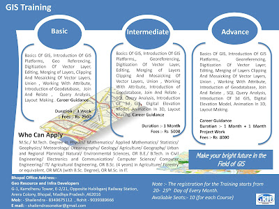
Note :- Short Term GIS and Remote Sensing Training is available in Bhopal MP

Thursday, May 19, 2016

GIS Image Processing Expert Quantum Asia - Hyderabad, Andhra Pradesh

GIS Image Processing Expert 

Quantum Asia - Hyderabad, Andhra Pradesh

Required Skills: 

Expertise in digital cartography, image processing, computer technology, GIS software, geospatial production techniques, remote sensing and photogrammetry
Knowledge of data management and trend analysis
Knowledge of commercial satellite imagery, SAR, and commercial airborne imagery data, products, processes, and sensors
Experience with ArcGIS server on Silverlight technology
Experience with .net server applications
Experience with Desktop based developments
Experience with Integration using SQL Server / Oracle
Experience in writing rest based web-services

Qualifications : 

Degree in CS (B.Tech/MCA), Geology or relevant field

Experience Required : 3-10 Years

Email : contacthr@quantumasia.in

_________________________________________________________

Note :- Short Term GIS and Remote Sensing Training in Available in Bhopal Madhya Pradesh..

Saturday, May 14, 2016

GIS Operator in Bhopal, Madhya Pradesh

GIS Operator 

WAVESTECH INDIA - Bhopal, Madhya Pradesh 
Minimum Qualification: Graduate Degree in Geography or Geology or Remote Sensing or Planning Minimum Experience: At least 3 years of experience in Development of Urban GIS Database.
Job Type: Full-time
Salary: ₹35,000.00 /month
Required experience:
  • GIS Operator: 3 years
Required education:
  • Bachelor's
--------------------------------------------------------------------------------------------------------------------------------


Note :- Short Term GIS and Remote Sensing Training in Available in Bhopal Madhya Pradesh..


Friday, May 13, 2016

GIS Expert in Bhopal, Madhya Pradesh

GIS Expert 

Company :- WAVESTECH INDIA - Bhopal, Madhya Pradesh 

Salary :- 50,000 a month
Minimum Qualification: Post Graduate Degree in Geography or Geology or Remote Sensing
Minimum Experience : At least 5 Years of experience using GIS in Hydraulic Modeling of water supply and sewerage Network & Management.
Job Type: Full-time
Salary: ₹50,000.00 /month
Required experience:
  • GIS Expert: 4 years
Required education:
  • Master's
----------------------------------------------------------------------------------------------------------

Note :- Short Term GIS and Remote Sensing Training is available in Bhopal MP


Monday, May 2, 2016

GIS /CAD ENGINEER Tricad Design Consultants (p) Ltd. - Hyderabad, Andhra Pradesh


GIS /CAD ENGINEER 

Tricad Design Consultants (p) Ltd. - Hyderabad, Andhra Pradesh

SkillSet: GIS, Auto CAD. GIS, RS and Photogrammetry Services for the India and overseas clients. Recognized by DoS for its GIS, RS and Photogrammetry services. TriCAD maintains high standards of excellence in client service and product quality.

Job Profile Key Skills: Having good knowledge in Auto CAD Handle project independently Job description: GIS and Auto CAD mapping NOTE: Minimum One year commitment /bond Salary based on experience


Note:- GIS Training is available in Bhopal. For more please contact to 8349675112 or mail me at shailendrasonekar@gmail.com.

Wednesday, December 30, 2015

GIS Executive Raj Technologies

GIS Executive

Raj Technologies
Experience :- 2 to 7 yrs
Salary As per Industry Standards
Location :-  Nasik
Key Skills :- data from source documents Data Collection Data Attribution  Geo referencing  Postgresql
Job Function IT/Telecom - Software
Industry IT-Software
Specialization :- Application Programming,Database Administration (DBA),Software Engineer
Qualification: Any Graduate 

Job Description

Summary of Typical Duties & responsibilities:

Correction and integration into existing mapping products.
Data Attribution , Geo referencing, Data Collection & the database preferred
Data inter-operation with existing data/ maps.
Creation of topology and attaching attribution, Geo referencing etc.
Interprets and transfers data from source documents
Rectifies images including geo referencing and image manipulation, point appurtenance features and
• Capture GIS data in different formats using GPS, electronic data recorders, digitisers, and other means.
• Download, convert and upload GIS data available from internal and external sources to make them usable.
• Perform GIS data quality control, including reviewing data for completeness and accuracy; identifying and correcting errors or omissions in the data.
• Catalog and inventory GIS data, including metadata creation.
• Input, update and maintain GIS databases, including backups and also maintaining linkages to other databases.
• Perform GIS spatial analyses.
• Create map layouts and views, and generate maps and reports.
• Develop new applications and train others in the use of these applications.
• Undertaking data analyses and data conversion.
• Coordinating the acquisition of new spatial data and supervising the integration of these data into the organization’s GIS.
• Developing and managing quality control procedures.
• Coordinating GIS activities with programmers and technicians.
• Providing support for GIS data conversion, systems integration and system’s and application’s development and implementation.
• Providing support for cartographic design and high quality map production.
• Assisting in training in various aspects of the GIS software and database creation and use.
• Diagnosing and “troubleshooting” problems experienced with the use of GIS and related software.

About Company: Raj Technologies

Raj Technologies is engaged in servicing its clients to resolve the pressing business needs using the GIS technology. Domain specific resources and the IT experts work together to understand the business needs, translate them in the technology and deliver the solutions. Raj Technologies specializes in GIS, CAD and developing software solutions. Since the last 10 years, it has been delivering high quality services across the globe. Primary solutions and products of Raj Technologies are used by Aviation industry and Real Estate.

Website :- http://www.rgistech.com/