Postdoctoral Fellow in Remote Sensing of
Coastal Ecosystems French Institute of Pondicherry - Puducherry, Puducherry
60,000 a
month
A 2-year
postdoctoral position is available from the 1st April 2019 in the GeoSMIT
department, French Institute of Pondicherry, Pondicherry, India. The position
offered will address the vulnerability of coastal ecosystems to a range of
socio-economic pressures and physical processes typical of the Tamil Nadu coast
facing the Bay of Bengal, as introduced in Muthusankar et al. (2018). Regions
of Pichavaram mangroves and Kalivelli wetland will be focused on. Changes in
the ecosystems themselves will be to described in function of surrounding land
cover and land use transformations. The work has to be carried out within the
framework of the 'Coastal transformations and fishing community wellbeing -
synthesized perspectives from India and Europe, FISHERCOAST" project,
funded by the EU-India Platform for Social Sciences and Humanities
(EqUIP)program. This is a ground-breaking interdisciplinary project involving
research in social science, economy, ecology geography and remote sensing.
The position
offers ample opportunity to the postdoctoral fellow for exposure to a rich
European and Indian international scientific environment with several missions
in Europe, international conference participation and close partnerships with
local stakeholders, such as the National Center for Coastal Research (NCCR),
Chennai and Tamil Nadu Universities. The work is based on a unique image
dataset including time series of very high spatial resolution multispectral
satellite images (see Proisy et al. 2018 and Viennois et al. 2016 for examples).
We seek to
hire a young Indian researcher, holding a Ph. D. in remote sensing or
equivalent, specialist in geosciences with demonstrated experience in spatial
analysis of land use / land cover changes using remote sensing imagery or in
the development of remote sensing methods for monitoring changes (of diverse
nature) in (coastal) environments. Knowledge of remote-sensed signal physics
and autonomy in data analysis (processing, statistics, modelling) using
programming software (Matlab, R, C, C++, Java, etc.) are desirable. Candidate
with prior work on remote sensing of coastal ecosystems, such as mangroves, are
particularly welcome. We will consider only candidates who have several
first-author publications in peer-reviewed journals.
Minimum Qualifications:
·
Indian
nationality
·
A Ph.D.
degree (i.e. candidates having only the Master degree will be automatically and
immediately rejected). Do not loose our and your time! Thank you.
·
At least two
peer-reviewed international articles
·
Proficiency
in English and proved communication skills (verbal and written)
·
Proficiency
in programming for multisource data analysis (using Matlab, R, etc.)
·
Basic
proficiency in any GIS software (ArcGIS, QGIS, etc.) and Remote Sensing
Software (ERDAS, ENVI, etc.)
Job description
Location:
GEOSMIT Department, French Institute of Pondicherry, Pondicherry
Starting date: Between 1st April – 1st July 2019, Full time
position, 24 months, 1-year + 1-year fellowship contract
60 000
INR/Month
How to Apply
Before 15
February 2019 BY EMAIL AT Dr MUTHUSANKAR G. and Dr. PROISY Christophe
Candidates
should apply by sending a single PDF file consisting of:
A CV
including a list of articles, which will distinguish peer-reviewed articles in
international journal with impact factor > 1 from other articles, book/book
chapters conference proceedings, oral communications. Any experience in project
management and student supervision is to be mentioned especially when the scope
is international.
A document
of 5 pages maximum summing up the research work carried out by the candidate
during and after his PhD and the main scientific reasons why he is applying for
this Postdoctoral fellow. This document can include graphs and should be
meticulously structured, written and presented.
The names
and contact information of three persons of reference
Shortlisted
candidates will receive the oral interview modalities to be planned in February
2019 at IFP. A slide presentation will be requested. Skype meeting may be
envisaged for candidates based outside India.
References
(click on the references below and ask for a private access to the articles):
Muthusankar,
G., Proisy, C., et al. (2018). When socio-economic plans exacerbate
vulnerability to physical coastal processes on the southeast coast of India.
Journal of Coastal Research, 85, 1446 – 1450
Proisy, C.
et al. (2018). Monitoring mangrove forests after aquaculture abandonment using
time series of very high spatial resolution satellite images: A case study from
the Perancak estuary, Bali, Indonesia. Marine Pollution Bulletin, 131, 61-71
Viennois,
G., Proisy, C. et al. (2016). Multitemporal analysis of high spatial resolution
satellite imagery for mangrove species mapping, Bali, Indonesia. IEEE Journal
of Selected Topics in Applied Earth Observations and Remote Sensing, 9,
3680-3686
Job Types:
Full-time, Contract
Salary: 60,000.00 /month
Experience:
·
Coastal
ecosystems: 3 years (Preferred)
·
Remote
Sensing: 3 years (Required)
Education:
·
Doctorate
(Required)
Language:
·
English
(Required)
----------------------------------------------------------------------------------------------------------
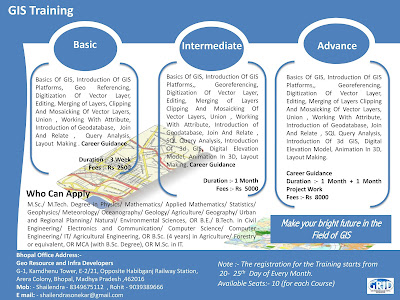
Note :- Short Term GIS and Remote Sensing Training in Available in Bhopal Madhya Pradesh..
For More Details please call : Mr Shailendra Sonekar (8349675112)
----------------------------------------------------------------------------------------------------------------------------------------------


